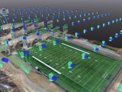
Survey Grade Accuracy
Understanding Survey Grade Accuracy
At SurveyLogic360, survey-grade accuracy means precision within 0.1'—a standard we uphold to ensure our clients can rely on our deliverables without hesitation. Our goal is to provide data that surveyors can trust and use immediately.
However, our accuracy is only as good as the data provided. While we apply rigorous processing and quality control to refine results, we cannot fix fundamental errors in the original data. If we detect issues, we will notify you immediately so you can make informed decisions.
Simply put—if the input data is solid, our results will meet survey-grade standards. If there’s a problem, you’ll know about it.
Want to learn more about drone accuracy, what it means, and how to ensure the highest precision in your data? Check out below